Building upon the themes of my Earth Day poster, I wanted to create an interface that could be utilized to teach both children and adults about the effects of climate change on the United States, with the hopes of inspiring change and leading them to take action against global warming. I used Adobe XD to build this prototype of an interactive map that lets users explore different regions of the nation and see the effects of climate change in each area. I researched the information in the prototype and used some artifacts and graphics from past projects to supplement the design. I wanted the prototype to be colorful with bold lines and large text, and have relatively large navigation buttons. This is so that it could be accessible for everyone, with no barriers of use for children, people with poor vision, or people with limited mobility in their hands and wrists, among others. Because climate change affects everyone, I felt that this prototype should be able to be used by and educate everyone as well.
Try out my prototype below!
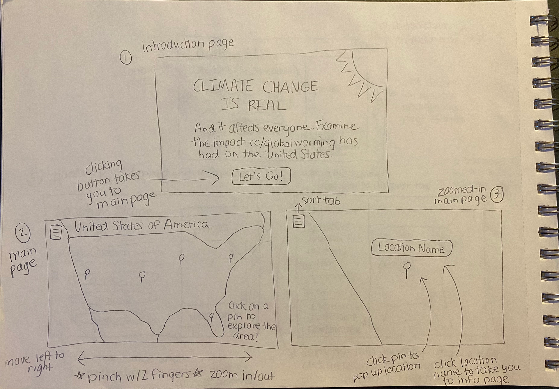
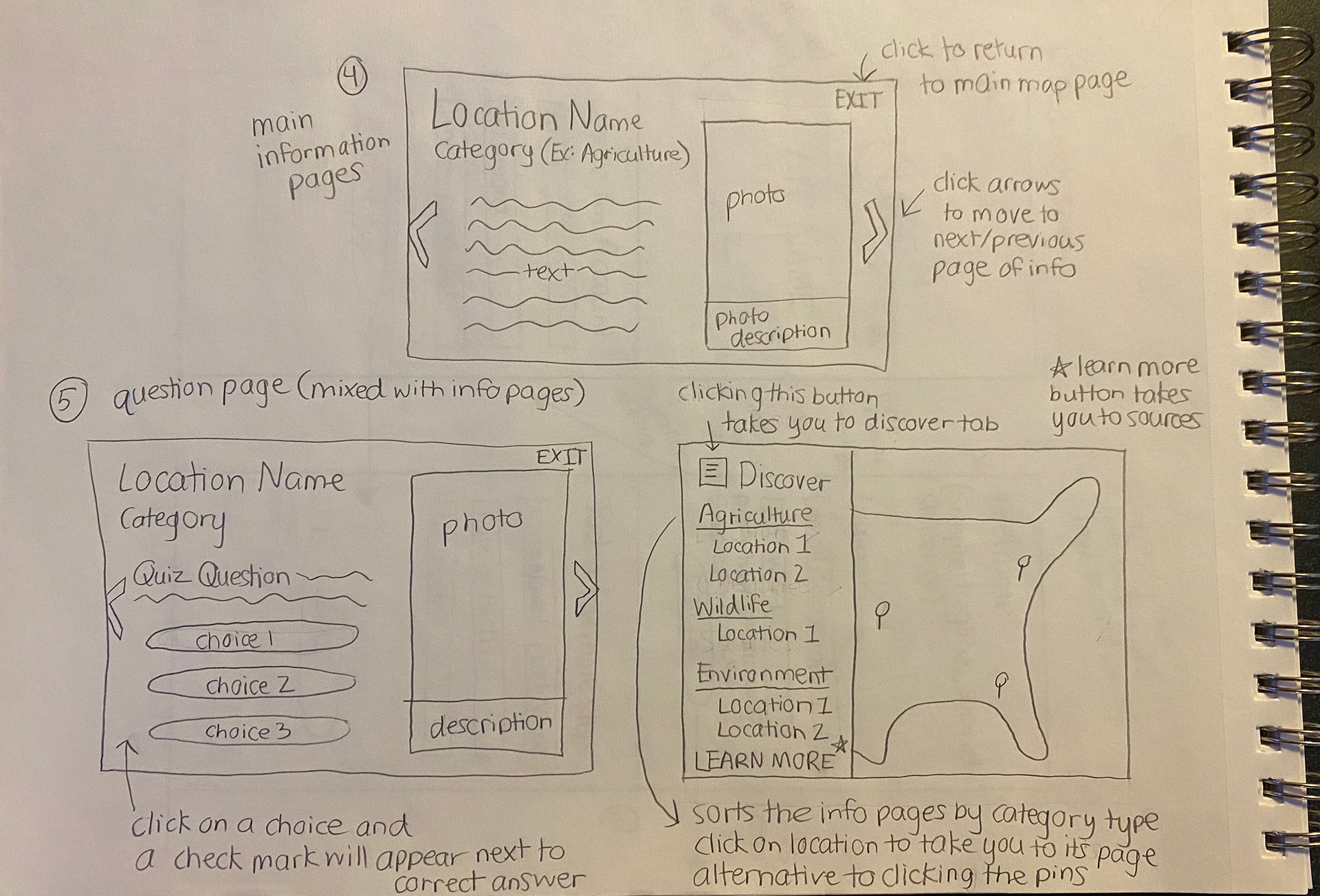
Here are the wireframes I sketched out to use as the basis for my prototype: